Fimmvörðuháls
Description
Take a breathtaking hike over the Fimmvörðuháls trail, one of Iceland’s most stunning — and challenging — routes. This iconic trail connects the roaring Skógafoss waterfall to the lush valley of Þórsmörk, stretching between two glaciers: Eyjafjallajökull and Mýrdalsjökull.
Along the way, you'll pass over black lava fields, hike beside dozens of cascading waterfalls, and walk through areas reshaped by the 2010 volcanic eruption that formed the twin craters Magni and Móði. Whether you're chasing solitude, adventure, or jaw-dropping views, Fimmvörðuháls offers an unforgettable highland experience — but be prepared. Weather can change in an instant, especially near the 1,000-meter-high pass.
Skógar - Baldvinsskáli
12km. 4-5 hours. 1000m ascent.
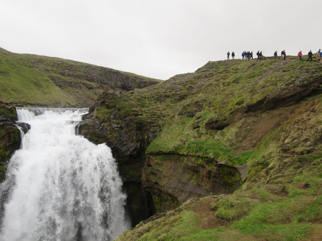
The journey begins at the iconic Skógafoss waterfall, where you'll climb the staircase next to the falls. Take your time — this first stretch is steep, and there’s plenty of beauty to admire along the way.
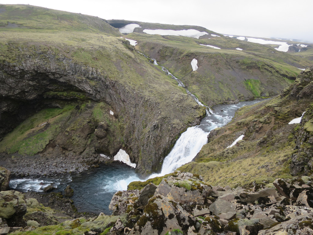
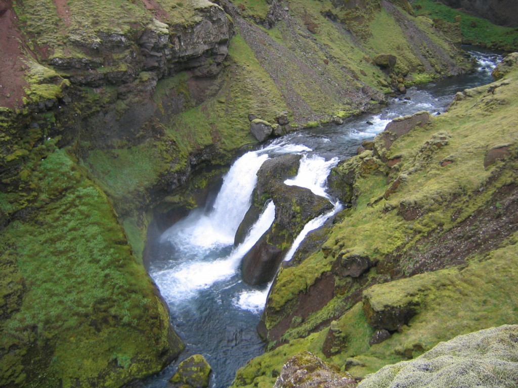
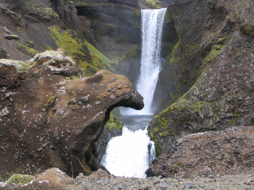
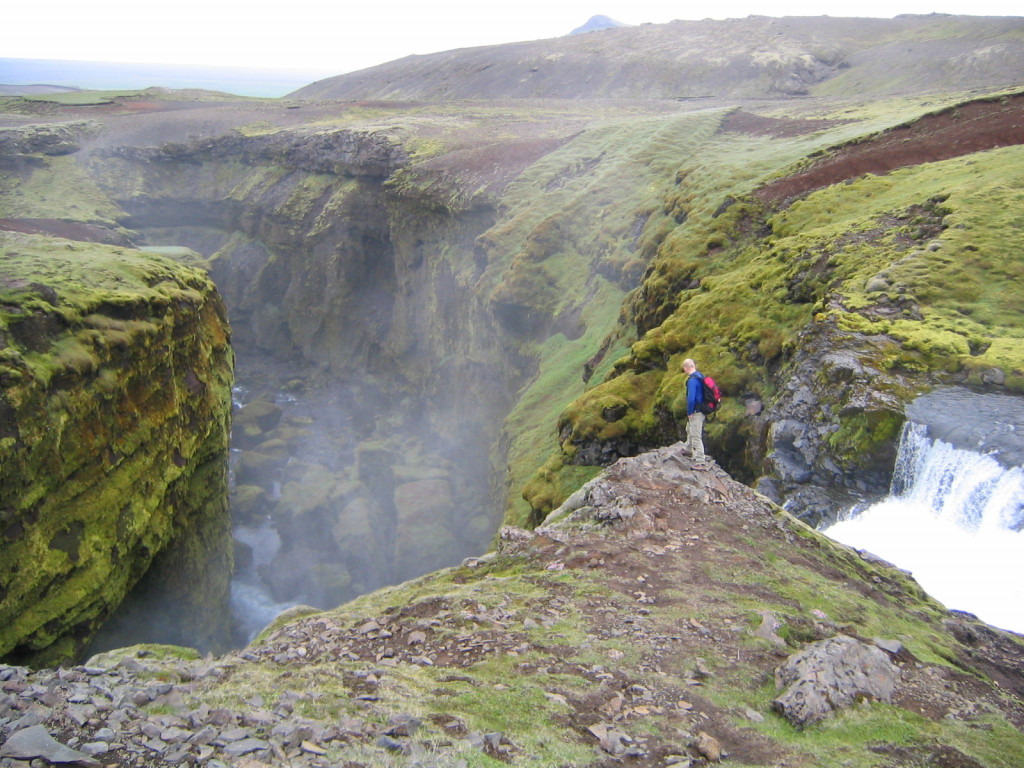
The trail follows the Skógá River uphill, revealing an incredible sequence of waterfalls, one after the other. Keep your camera handy — these are some of the most photogenic spots in southern Iceland.
After about 8 km, you'll reach a bridge crossing the river Skógá. This is a good spot to fill up your water bottle.
From here, most hikers continue along a gravel road leading to Baldvinsskáli hut, another 4 km up. Alternatively, you can take a marked trail west of the road to Fimmvörðuskáli hut, a slightly longer and less-traveled route.
- The hut: Baldvinsskáli hut accommodates 16 people. The kitchen is equipped with gas stoves, utensils and cold running water. The outhouse is right outside the hut.
- The campsite: Camping outside Baldvinsskáli is frequently done, though there is no good soil for staking down tents, nor any proper shelter. In bad weather, camping is not an option on Fimmvörðuháls trail.
- Not far from Baldvinsskáli is another hut - Fimmvörðuhálsskáli, operated by Útivist.
Garbage disposal: You will need to carry your trash to the next hut.
Baldvinsskáli - Þórsmörk
13km. 4-6 hours.
From Baldvinsskáli, the trail crosses Fimmvörðuháls, often snow-covered well into summer. It's marked with stakes, but conditions can change fast — be prepared for fog, strong winds, or sudden storms.
After around 3 km, you reach Goðahraun, a lava field formed in the 2010 eruption. Nearby, the craters Magni and Móði are worth a short detour for sweeping views of the volcanic landscape. A memorial cairn follows, commemorating hikers who succumbed to the elements in 1970 — a powerful reminder of the area's rugged nature.
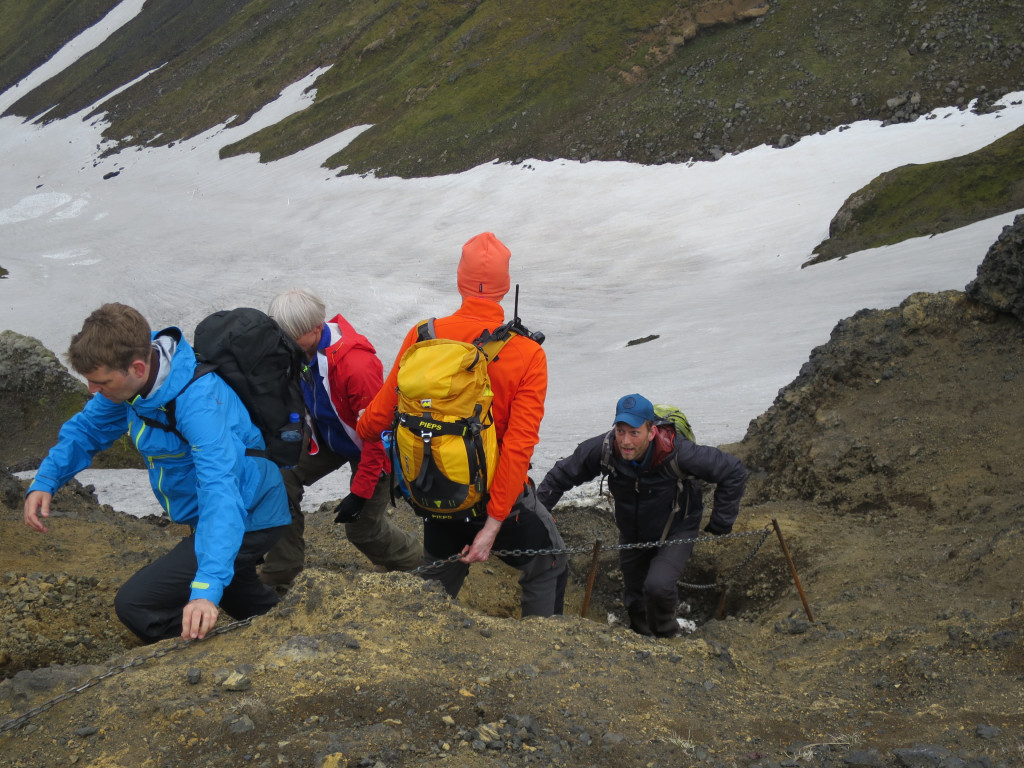
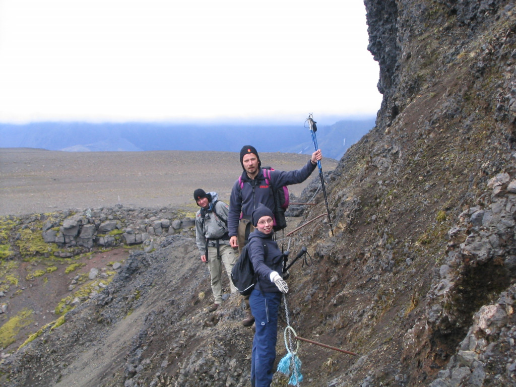
Next is Brattafönn, a steep slope that can stay snowy into summer and may be slippery even when dry. The trail then crosses Heljarkambur, a narrow ridge with a support chain on the most exposed section — dramatic, but manageable in good weather.
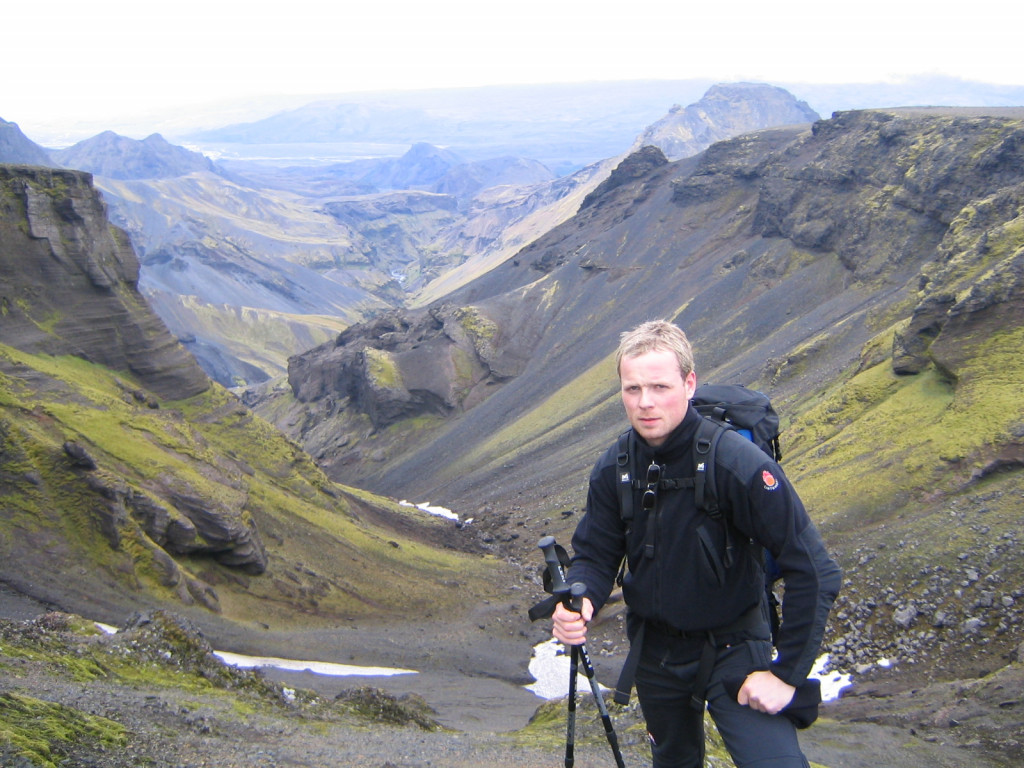
From here, the terrain shifts. Morinsheiði offers panoramic views of Mýrdalsjökull and Katla, before the path narrows again over Kattarhryggir ("Cat’s Spine"). It looks intimidating, but safety upgrades have made it more approachable — though hikers with vertigo may want to take their time.
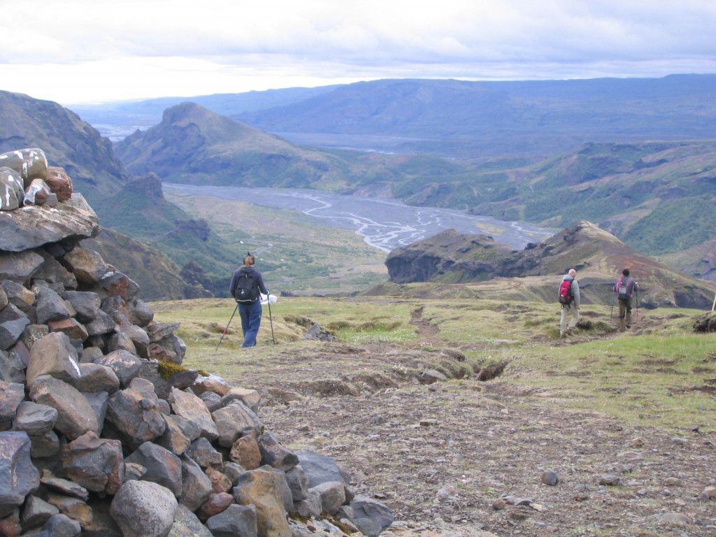
The final descent into Strákagil is steep, but leads into a lush, green valley. Mossy rocks, birch trees, and wildflowers replace the volcanic landscape. You’ll arrive at the Goðaland hut (Útivist), with the Langidalur hut 2 km further, across a footbridge over the Krossá River.
Which direction?
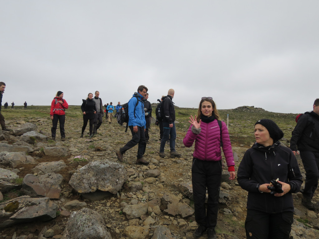
Most people hike from Skógar to Þórsmörk, as the ascent is more gradual and the series of waterfalls along Skógá are in front of you the entire way. The final descent into Þórsmörk is also a stunning reward.
That said, those finishing Laugavegur trail usually go in reverse, starting in Þórsmörk and powering up to Fimmvörðuháls before cruising downhill to Skógar.
Clothing
- Layered Clothing: The weather can change rapidly, so it's crucial to have layers. Include a moisture-wicking base layer, insulating mid-layer, and a waterproof outer layer.
- Hiking Boots: Sturdy, waterproof boots are essential for the varied terrain, including rocky paths, snow-covered sections, and river crossings.
- Hat and Gloves: For warmth and protection against the elements. A buff or neck gaiter can also be a good idea.
- Socks: High-quality, moisture-wicking socks to keep your feet dry and comfortable.
- River crossing shoes: Lightweight sneakers that dry quickly or sandals are a popular choice.
Camping Gear (if camping)
- Tent: Lightweight and weather resistant.
- Sleeping Bag: Suitable for cold temperatures.
- Sleeping Pad: For insulation and comfort.
- Cooking Equipment: Portable stove, fuel, and cooking utensils.
Personal Items
- Backpack: A 50-60L backpack. If camping, you may need to bring a 60-70L pack.
- Water Bottle/Hydration Pack: Staying hydrated is crucial.
- Food: While hiking, you will need more energy than usual. Make sure to have enough food. Here you can see what food is for sale in our huts.
- Navigation: GPS device, map and compass.
- First-Aid Kit: Including blister treatment and any personal medications.
- Multi-tool: Handy for various tasks.
- Headlamp/Torch: For visibility at night.
- Dry Bags: To keep your gear dry.
- Sunglasses and sunscreen: Rain is common in the highlands, but so is sun!
- Toiletries: Toothbrush, toothpaste, soap and perhaps a small towel if you plan to shower. Earplugs may also come in handy.
- Dry clothes: It can rain a lot on the trail and your raingear may not be able to keep up with Icelandic weather. An extra set of dry clothes is recommended.
Miscellaneous Gear
- Trekking Poles: Helpful for stability on uneven terrain.
- Repair kit: If any of your gear is damaged.
- Camera: To capture memories from the trail.
The whole trail is well marked and in good weather the danger of getting lost is minimal. However, in bad weather and fog, when visibility is close to zero, everything will change. This is especially true ath the top of the Fimmvörðuháls pass. This part of the trail sees a lot of fog and bad weather and in early summer this area can also be covered with snow.
Weather
Summer Weather (June to August):
- Temperatures: During the summer months, daytime temperatures typically range from 5°C to 14°C. At night, temperatures can drop to between 0°C and 10°C, depending on where you are on the trail.
- Rain: Rain is common. It's essential to have waterproof gear, including a good rain jacket and waterproof pants.
- Wind: Wind can be a significant factor on the trail. Wind speeds can vary, but anything above 10-12 meters per second can make hiking conditions challenging. Be prepared for strong winds, especially in exposed areas.
Spring and Autumn Weather (May, September):
- Temperatures: Temperatures can be cooler, with daytime highs around 5°C to 10°C and nighttime lows potentially dropping below freezing.
- Rain and Snow: Rain is still common, and there's a possibility of snow, especially at higher elevations. Waterproof and warm clothes are crucial.
- Wind: Wind speeds can be similar to those in summer, so be prepared for strong gusts.
General Tips:
- Check the Forecast: Always check the weather forecast before starting your hike. Reliable sources include the Icelandic Meteorological Office and Blika.
- Be Flexible: Weather conditions can change rapidly, so be prepared to adjust your plans if necessary. It's a good idea to have a flexible itinerary.
- Talk to Wardens: Speak to the wardens at Landmannalaugar before you start and at each campsite along the way. They can provide up-to-date information on weather and trail conditions.
Phone connection can be unstable on the trail and you might have go to the nearest hilltop to find a network.
You will not be able to connect to WiFi in the huts, but may find a few spots along the trail where a 4G connection is possible.
Emergencies
Emergency Services: In case of an emergency, contact 112. Make sure you have a way to call for help.
When is it open?
Access and passage on the trail vary from year to year depending on weather and snow conditions.
On average one can assume that the trail is open from June 25 to September 15.
Þórsmörk usually opens sooner or in the beginning of May.
Respect the nature
Those who hike in Iceland do so to experience the spectacular nature along the trails. The Icelandic environment is very fragile and all hikers must exercise great care and respect for the nature.
Please stay on the trail, only pitch your tent in designated camping grounds, avoid stepping on the fragile moss or leave marks or trails where there are none. It only takes one set of footprints for many more to follow.
We emphasize that nothing can be left in nature, neither organic leftover food nor toilet paper. The general rule is to leave nothing but footprints on the trail and take nothing but pictures and memories.