
Skallahringur frá Laugum
Description
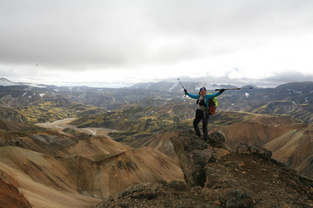
The Landmannalaugar area has many well-marked hiking paths. Ferðafélag Íslands has made a map of all these paths that can be bought in Landmannalaugar as well as online. One of the most popular hikes around this diverse and beautiful area is the so-called Skallahringur. The hike starts by the hut in Landmannalaugar. The trail takes you over the sands below Brandsgil and then up to Vörðuhnúkur. Then onwards higher on the site of Skalli up to almost 1000 meters. A popular detour to take is to walk up to the top of Skalli. On a clear day, it is hard to find a better view over Jökulgil and Torfajökull. From Skalli, the route continues along the edges of Jökulgil with many great opportunities to carefully peek over the edges and admire the diversity of Jökulgil gorge. You will come across two peaks more, called Suðurskalli and Gráskalli, but soon after that, the path takes you away from the gorge and on to a plane until it connects to the Laugavegur trail. Here you will find yourself right above Brennisteinsalda and the trail takes you back to Landmannalaugar again. Skallahringur has great views; colourful liparite and various transformations caused by geothermal heat. It is likely that you will be intoxicated from the beauty of nature when you come back to Landmannalaugar where you can relax in the hot pool after a good day of hiking.